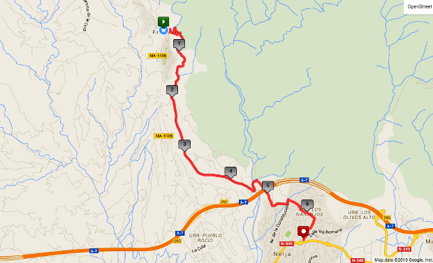
Via The Higuerón Barranco and Rio Higuerón
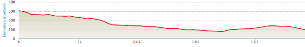
Distance: 6.5 km Time: 2 1/2 hours Difficulty Rating: Medium
MapMyWalk Link PDF Link (available to SpainAway guests)
This is essentially the exact reverse of the Nerja - Frigiliana (2) route. Thus from the start point of the roundabout just below the old sugar factory, take the slope up to the junction between the new and old parts of Frigiliana, just down the ramp from the old sugar factory, keeping on straight ahead just to the left of the Unicaja bank.
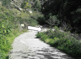 Continue down the steep hill from here until you reach the river bed below (the Rio Higuerón). Then at the bottom turn right down by the side of the river bed itself, as shown left. If you were to go straight on you would see a sign for ‘Sendero Frigiliana – Fte del Esparto 600 m’, which is in fact the direction followed by our Frigiliana – Nerja (5) route. Essentially from here you will be following the river bed down through a steep gorge until it reaches a point where it all levels out at the point where a concrete road from La Molineta joins from the right. From this point on the return route is the same as that for the Frigiliana – Nerja (1) route.
Although the route notionally follows the river bed, there are occasional deviations off to the side to pick the easiest route, and to some extent you may wish to choose these yourself, dependent on the level of vegetation and (potential) water level. Periodically there are blue paint splodges on boulders to the side of the path, which shows that you are on some sort of OK route.The only real difficulty here comes when you reach a quite short waterfall (or drop). Here you can either choose to slide down its bank at the side, or take a brief detour to the right, by a pipeline, jumping across a pool at the base of the waterfall. Either way you may get your feet a little bit wet! Following the course of the river down there are places where you have to walk along the river bed (there’s probably not very much water flowing), or, briefly, along tracks bordering either the right or left hand sides.
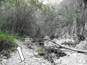 When you reach the point shown in the picture left (if you can recognise this), we suggest taking off to the left, higher up, for a while. This will take you past an old fountain and onto a short cobbled stretch. Soon after this you will reach the final difficulty which is a flight of concrete steps not very high above the river bed below. Sometimes there is a rope handrail on either side, but it sometimes disappears. Once the terrain opens up again, and you pass the road coming down from La Molineta to your right, do ensure that you keep straight on down by the side of the river bed ignoring all turns off. Then after a couple of kilometres walking beside the path of the river, you will reach the confluence with the Rio Chillar, just before the motorway.
You need to turn left now, up by the northern side of the Chillar (you can either cross it at the vehicle ford, or go a few metres downstream and cross at a concrete culvert). You should then take a road off to the right after a short distance, at a point where you will see both a ‘Parking’ and a ‘No Entry’ sign. After a few metres take the right hand at the junction reached and turning right at the T-junction at the top then climb back out of the valley. Once you reach the summit, by a line of pylons , continue to retrace your route, turning left up to San Juan onto the Avenida de la Constitución, at the end of C/ Mirto, and then right onto the road skirting the bottom of the San Juan, and onto Camino de Ronda at the top end of El Capistrano Village.